Oregon DOT creates webpage for wildfire road closures
Wildfires continue to burn in the West Coast at a historic rate, keeping roads closed for long stretches of time. The Oregon Department of Transportation has created a webpage to help motorists find out about closures related to wildfire activity.
Since August, dozens of highways in California, Oregon and Washington state have been closed as the region suffers through one of the most devastating wildfire seasons on record. In California, five active wildfires are among the top 10 largest in state history:
- August Complex: Largest in state history at more than 800,000 acres and only 30% containment as of publication.
- SCU Lightning Complex: Third largest in state history at nearly 400,000 acres and 98% containment.
- LNU Lightning Complex Fourth largest in state history at more than 360,000 acres and 98% containment.
- North Complex Fire: Sixth largest in state history at nearly 300,000 acres and 36% containment.
- Creek Fire: Tenth largest in state history at more than 200,000 acres and 18% containment.
The situation in Oregon is not much better. The Oregon Department of Forestry is currently monitoring 12 major wildfires. The five largest fires are:
- Beachie Creek, 15 miles north of Detroit (more than 191,000 acres at 20% containment).
- Lionshead, 20 miles west of Warm Springs (nearly 190,000 acres at 10% containment).
- Holiday Farm, 3 miles west of McKenzie Bridge (more than 170,000 acres at 8% containment).
- Riverside, 2 miles southeast of Estacada (more than 135,000 acres at 3% containment).
- Archie Creek, 20 miles east of Glide (more than 128,000 acres at 20% containment).
In Oregon, about 1 million acres have burned this year, nearly twice the 10-year average. All state forests are closed to the public due to wildfire danger.
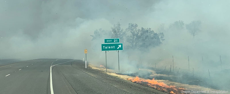
While the Oregon Department of Forestry is scrambling to manage the wildfires, ODOT is busy trying to manage affected roadways. According to a news release, the department is assessing damage on hundreds of miles of roads. Part of its job is removing thousands of damaged trees.
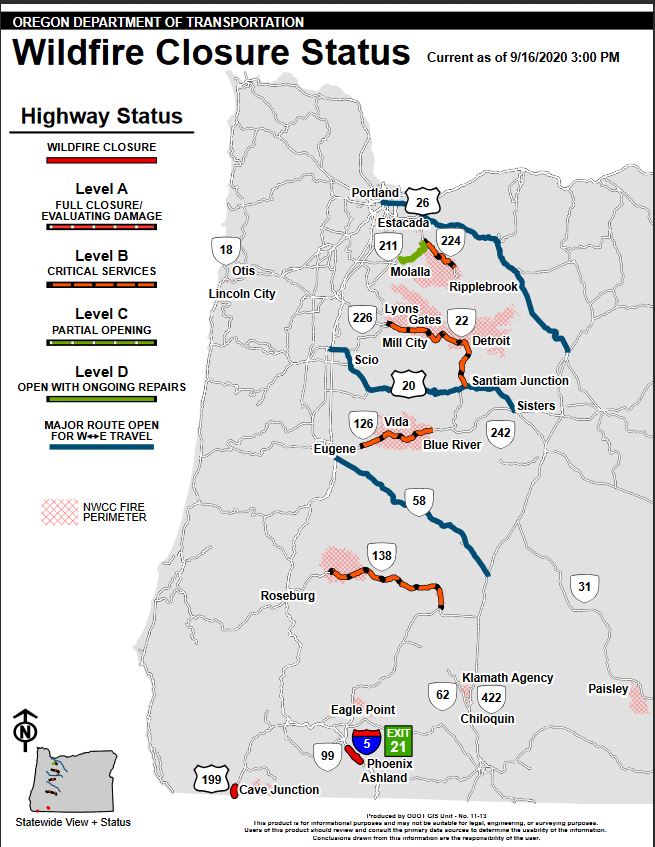
Keeping up with which roads are closed can be exhausting. Fortunately, ODOT has created a webpage dedicated specifically to wildfire-related road closures. Within that webpage is a map showing where roads are closed.
Unfortunately, finding wildfire-related closures in California and Washington is not as easy. However, both states have real-time maps showing road closures. As of Friday morning, Caltrans is reporting the following fire-related closures:
- State Route 1 from Gorda to Camaldoli Hermitage.
- State Route 2 from 1,000 feet east of Angeles Forest Highway to Islip Saddle/Route 39.
- State Route 39 from San Gabriel River Bridge to East Fork Road.
- State Route 168 from Prather Road to east end of Huntington Lake.
- State Route 199 from Pioneer Road to Oregon state line.
- State Route 236 from Little Basin Road to Waterman Gap Road.
In Washington, two road closures are being reported due to wildfire activity. US 12 is closed near mile marker 138 and the junction of U.S. 12 and state Route 123 from the east. Westbound traffic is stopped at mile marker 183 in Oak Creek two miles west of the junction of U.S. 12 and state Route 410. Also, WSDOT is reporting a fire on state Route 410 at mile marker 29 near Mud Mountain Dam Road. LL
Related News